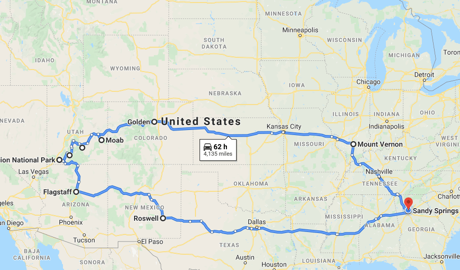
I wanted to create one post about the entire trip and have an outline of all the places we visited. The trip was amazing and incredible, and I could not have asked for a better road trip partner. So here is every stop we made. I hope this helps with your future trips out west!
Day 1-4: The Road to Utah
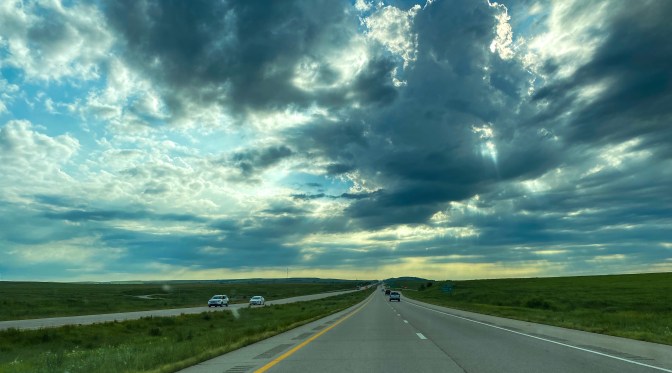
- Day One:
- Mt. Vernon, IL (overnight)
- Day Two:
- Cahokia Mounds National Historic Site in Collinsville, IL
- Ulysses S. Grant National Historic Site in St. Louis, MO (where we picked up our America the Beautiful Annual Pass)
- Salina, KS (overnight)
- Day Three:
- The Czech Capital of Kansas and the World’s largest Czech egg in Wilson, KS
- The World’s Largest Easel in Goodland, KS
- Golden, CO (overnight)
- Day Four:
- Loveland Pass – US-6 off I-70 to take the scenic route on the Continental Divide
- Colorado National Monument in Grand Junction, CO
- SR-128 to Moab instead of I-70 – highly recommended scenic route!!
- Moab, UT (overnight)
Day 5: Arches National Park
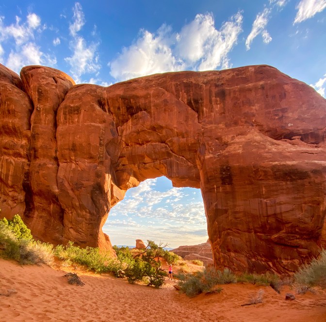
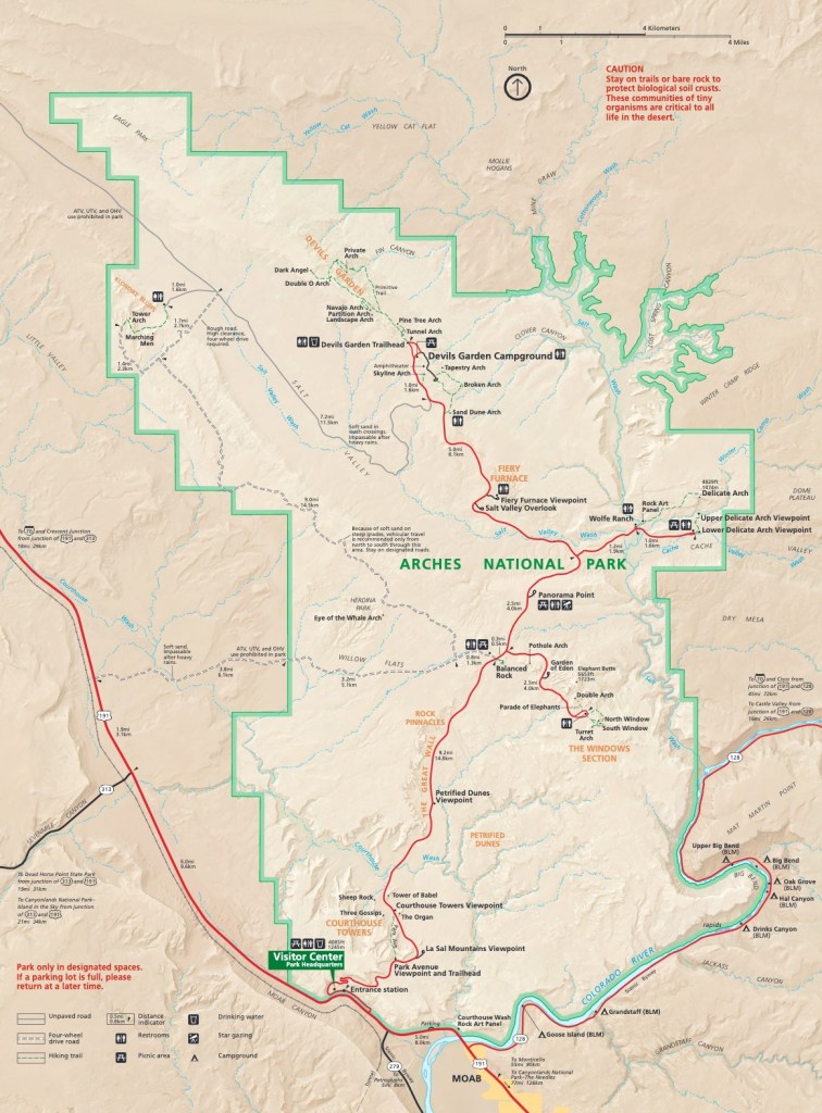
- Morning hike: Devil’s Garden Trail
- To Landscape Arch (1.6 miles roundtrip (RT) – easy)
- Keep going to Double O Arch (5+ miles RT – difficult) *This is what we did*
- Take the spur trails to Navajo and Partition Arches and Pine Tree and Tunnel Arches *Also did – you see all 6 arches*
- If you want to keep going, hike to Dark Angel (1+ mile longer RT)
- If you want to make the hike even more adventurous, take the Primitive Trail back to the trailhead, but be careful! (7.2 mile loop)
- Skyline Arch
- Easy short 0.4 mile RT hike to the arch and back
- Delicate Arch Viewpoints
- Lower Viewpoint: easy 100-yard paved trail
- Upper Viewpoint: 0.5 mile RT trail uphill
- The Windows Section
- 1 mile RT to see The North and South Windows and Turret Arch
- From the same parking lot, hike 0.5 miles RT to Double Arch
- You can also see the Parade of Elephants rock formation from here
- Garden of Eden
- Parking lot and short little walk out onto the rocks to see the rock formation Garden of Eden
- Pothole Arch can also be seen from the car on the way back out to the main road
- Balanced Rock
- There is a 0.3 mile RT trail that goes to a viewpoint. We viewed it from the car as parking can get a bit crazy
- Courthouse Towers Viewpoint
- From here you can see Sheep Rock, Baby Arch, and The Three Gossips
- Visitor Center
- Had to stop at the park store!
Day 6: Canyonlands National Park (and Arches NP)
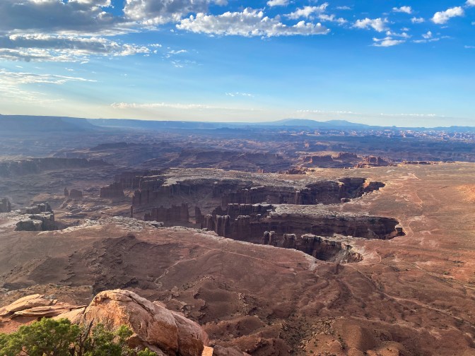
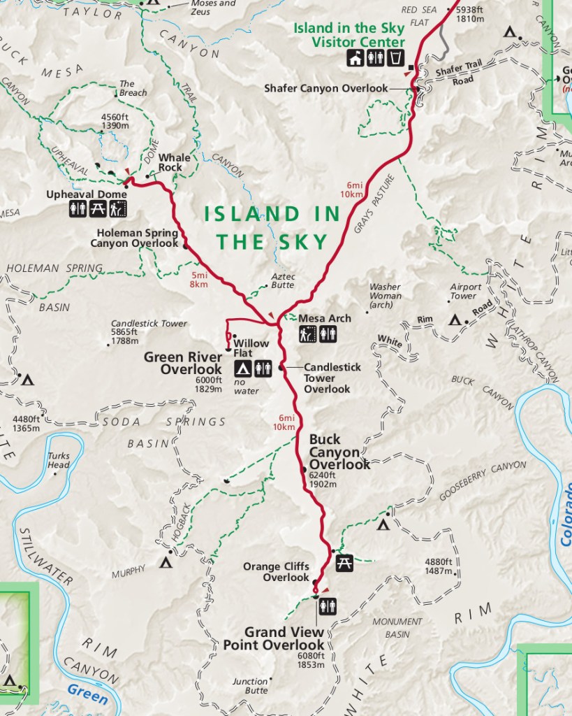
- Sunrise hike: Mesa Arch
- 0.5 mile RT hike to a cliff-edge arch
- Get here to watch the sunrise through the arch, but be prepared to share the view with a bunch of photographers
- Grand View Point
- There is an easy 2 mile RT hike you can do, but we opted to stay up top at the overlook
- Orange Cliffs Overlook
- Short walk out to an overlook of these amazing cliffs – go in the morning to get the really orange color
- Morning hike: White Rim Overlook
- Easy 1.8 mile RT hike to a rock outcrop overlooking both the Colorado River Canyon and Buck Canyon
- Buck Canyon Overlook
- Green River Overlook
- Whale Rock
- While we didn’t hike this, I’ll add it for anyone who would enjoy walking across a sandstone fin – moderate 1 mile RT hike
- Upheaval Dome Overlooks
- First Overlook: 1 mile RT short, steep trail
- Second Overlook: Adds 1 mile RT and some elevation change
- Aztec Butte
- 2 mile RT moderate hike with a forking path
- One way travels to the smaller butte up to ancient Puebloan granaries built on the side of cliffs
- The other travels to the larger butte where you must scramble and climb up slickrock and ledges to see some spectacular views
- Shafer Trail Canyon Overlook
- Visitor Center + Viewpoint
- Across the road from the Visitor Center is a viewpoint overlooking the Shafer Trail and Canyon from a different angle
- Sunset hike: Delicate Arch (Arches NP)
- 3 mile RT difficult hike climbing up slickrock and across narrow ledges to the arch
- Make sure to stop at the Rock Art Panel to view the petroglyphs preserved here
- Ideal to get to the arch 30 minutes before sunset, so make sure you time that out correctly. And don’t forget to bring a flashlight for the end of the hike back to the parking lot
- After Dark: Panorama Point (Arches NP)
Day 7: Capitol Reef National Park
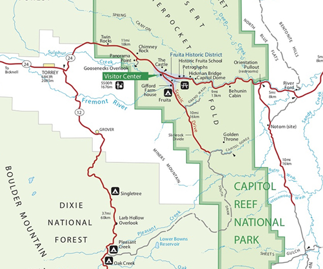
- Behunin Cabin
- Petroglyphs
- There are two areas to view petroglyphs: one is right by the parking, and the other is a short walk down a boardwalk
- Historic Fruita Schoolhouse
- Visitor Center
- Old Blacksmith Shop
- Gifford House Museum & Store
- Make sure to go in and get some of the homemade pies, bread, cinnamon rolls, and ice cream! There’s also a bunch of jarred salsas, relishes, pickled veggies, jams, fruit toppings, etc.
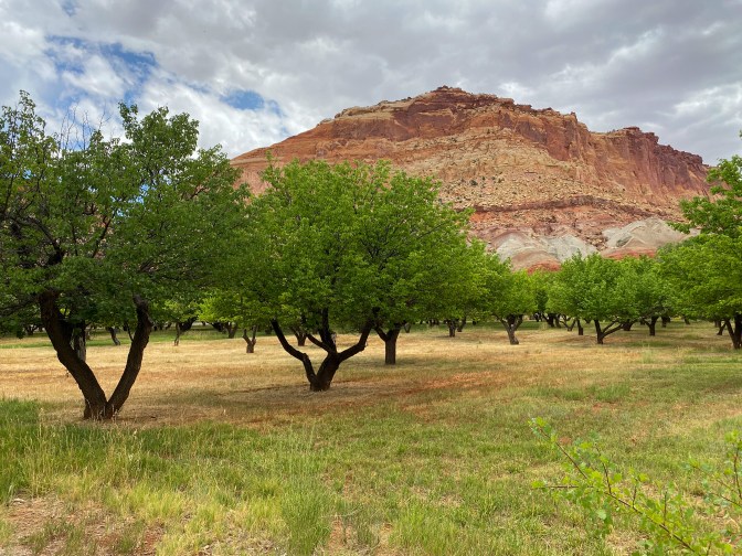
- Fruita Orchards
- If they are in season, be sure to go pick some fresh local fruit right of the branch! It’s free if you eat it in the park and costs a little if you take it with you.
- Fremont River Trail
- The whole trail is 1 mile one way along the river and up to some panoramic views – we only hiked part of it near the campgrounds
- Down the Scenic Drive
- Danish Hill
- Grand Wash Road
- Cassidy Arch – there is a 1.7 mile strenuous trail up to the arch that we didn’t do. You can see the arch from the road!
- Old Uranium Mines
- Slickrock Divide
- Capitol Gorge Trail
- Easy 2 mile RT hike through a gorge to see more petroglyphs and the Pioneer Register
- The final 0.2 miles is a spur trail to The Tanks that’s a bit of a climb
- Egyptian Temple
- The Castle
- Goosenecks
- Easy 0.2 mile hike to the Goosenecks Overlook
- Sunset Point
- Easy 0.8 mile hike to panoramic views that are good for sunset as the sun hits the Waterpocket Fold and the cliffs
- Panorama Point
- Chimney Rock
- Just like Cassidy Arch, there is a strenuous 3.6 mile RT hike to see Chimney Rock up close. We just viewed it from the car.
- Torrey, UT (overnight)
Day 8: Scenic Byway 12 (and Capitol Reef NP)
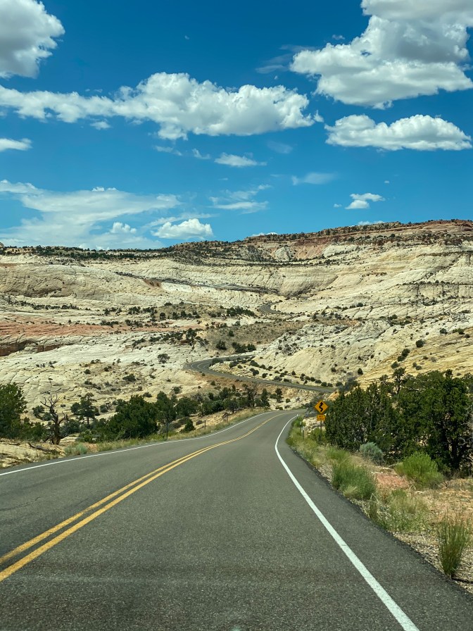
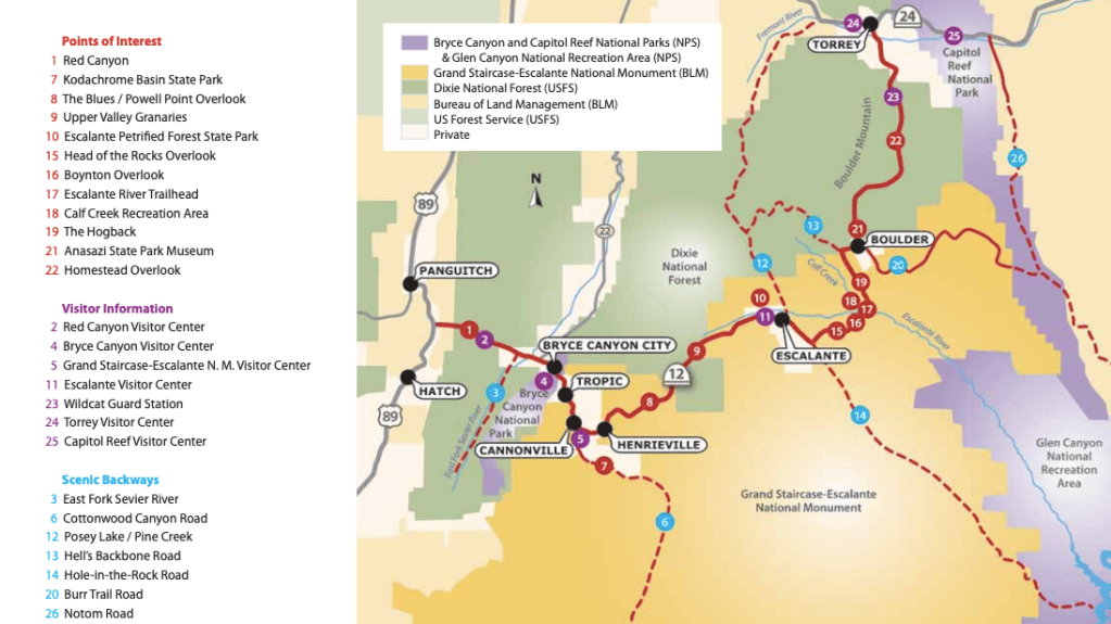
- Morning hike: Hickman Bridge (Captiol Reef NP)
- 1.8 mile RT moderate hike to a natural bridge
- Pectols Pyramid
- Capitol Dome
- Fern’s Nipple
- Scenic Byway 12
- Larb Hollow Overlook
- Homestead Overlook
- Boulder, UT
- Anasazi State Park Museum
- Hogsback – remember to drive slow and stay focused on the road
- Grand Staircase-Escalante National Monument
- Boynton Overlook
- Head of the Rocks Overlook
- Escalante, UT
- Hole in the Rock Heritage Center
- Escalante Visitor Center
- Escalante Petrified Forest State Park
- Nature Trail – 2 mile RT hike up to a plateau with a petrified forest
- Upper Valley Granaries
- The Blues / Powell Point Overlook
- Tropic, UT (overnight)
Day 9: Bryce Canyon National Park
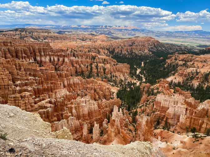
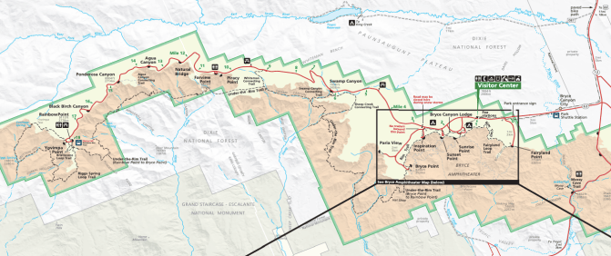
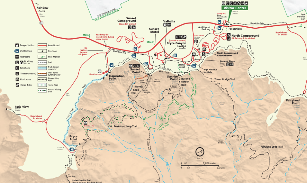
- Morning hike: Figure 8 Combination Loop
- Starting / Ending point: Sunset Point
- 6.4 mile strenuous loop that combines Sunrise Point, the Queen’s Garden Trail (down into the canyon), the Peekaboo Loop, and the Navajo Loop (coming out of the canyon).
- We went up the Wall Street side of the Navajo Loop and then turned down the other side of the loop to see Thor’s Hammer at the top of the canyon
- Yovimpa Point
- Bristlecone Pine Loop – easy 1 mile loop hiking through forests
- Rainbow Point
- Black Birch Canyon
- Ponderosa Canyon
- Agua Canyon
- Natural Bridge
- Farview Point & Piracy Point
- Swamp Canyon
- Inspiration Point – make sure to hike to all three viewpoints, as the view gets better each time!
- Bryce Point
- Fairyland Point
Day 10: Road to Zion
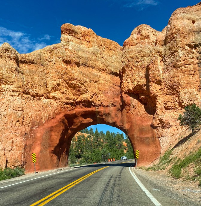
- Morning Hike: Mossy Cave (Bryce Canyon NP)
- Easy 1 mile out-and-back hike to a mossy grotto and waterfall alongside a stream
- Parking can be hard to find, so go either early in the morning or after 4-5pm
- Scenic Byway 12
- Red Canyon
- Drive under the two tunnels
- Pink Ledges Trail – easy 1 mile nature trail
- Red Canyon
- Zion National Park
- Checkerboard Mesa pullover
- Canyon Overlook Trail
- 1 mile RT that is fairly easy but maybe not best if you have a fear of heights, as there are some sections with some drop-offs
- Drive through the 1.1 mile Zion-Mt.Carmel Tunnel
- Great Arch pullover
- Springdale, UT (overnight)
Day 11: Zion National Park
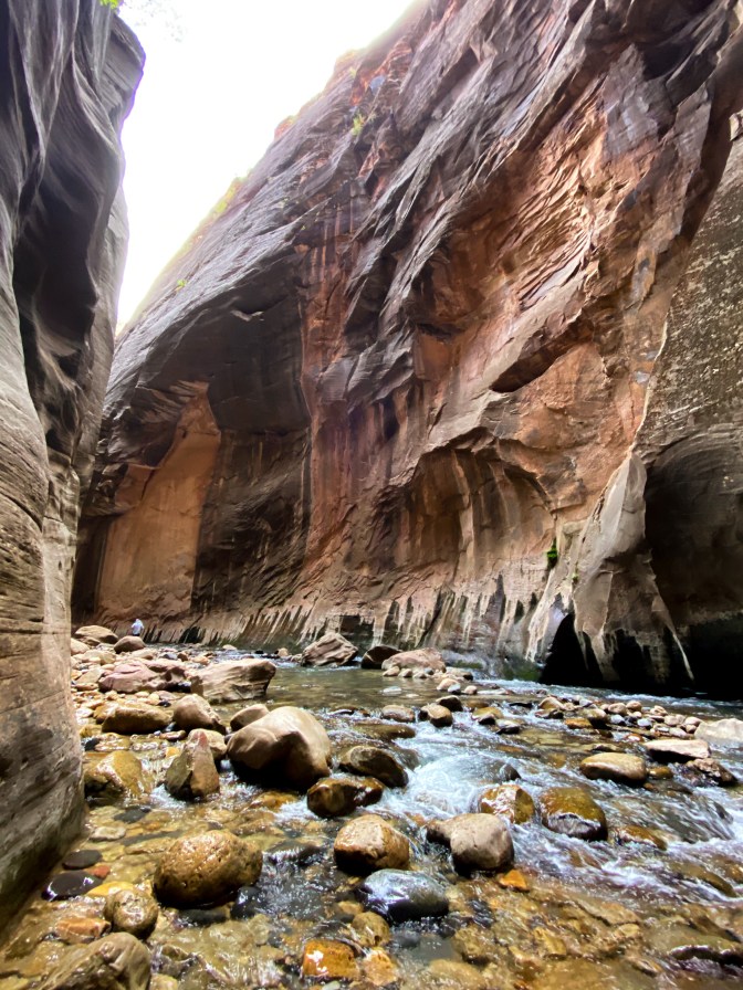
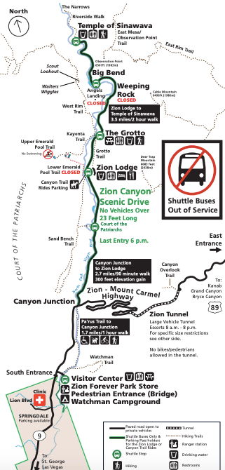
- Morning hike: The Narrows
- This hike can be anywhere from 2-10 miles RT, depending on where you turn around
- Riverside Walk to Gateway to the Narrows: 1 mile one way
- Mystery Falls: 1.5 miles one way
- Orderville Canyon: 3 miles one way
- Veiled Falls
- Wall Street begins: 3 miles one way (right after Orderville Canyon) *This is about when we turned around*
- Floating Rock is a good signal you’re in Wall Street
- Big Springs: 5 miles one way
- While some will say you don’t need it, I suggest renting neoprene socks, water boots, and a hiking stick. They all come as a package for about $25/day from local outfitters in Springdale. You can also rent dry bags, too. All of this just made the experience smoother, our feet weren’t freezing, and our hiking shoes didn’t have to get wet!
- Zion Lodge for lunch
- Lower Emeralds Pool Trail – easy 1.2 mile RT hike to the “pools / waterfalls”
- Currently this trail doesn’t connect to the Upper Emerald Pools, but once they restore that trail, you will be able to get to the Upper Pools from here
- Pa’rus Trail
- Easy 3.5 mile RT paved hike through Zion Canyon following along the Virgin River
Day 12: HWY 89A
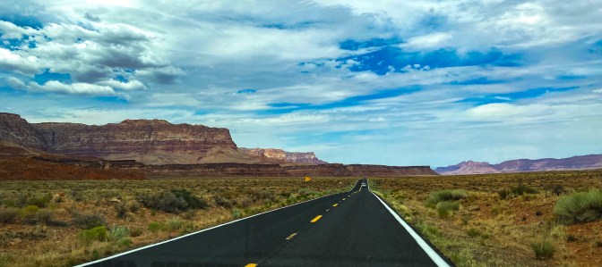
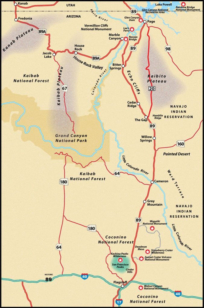
- Belly of the Dragon – 18 miles before Kanab, UT on HWY 89
- Sand Caves – ~6 miles before Kanab
- Le Fevre Overlook – a little past Fredonia, AZ
- Jacob Lake – make sure to stop and get some cookies at the Inn
- Vermillion Cliffs Overlook at House Rock Valley
- Dominguez-Escalante Expedition Trail historic marker
- Cliff Dwellers
- Glen Canyon – Lees Ferry
- Paria Beach – where you can touch the Colorado River
- Historic Trail and Spencer Trail if you have time!
- Navajo Bridge – if you have time, walk across the pedestrian bridge
- Sunset Crater Volcano National Monument
- Bonito Vista Trail – 0.3 mile RT paved trail through cinder fields
- Lava Flow Trail – 1 mile RT down into the cinder fields by the base of the volcano
- A’a Trail – 0.2 miles RT into a ‘lava lake’
Day 13-15: The Road Home
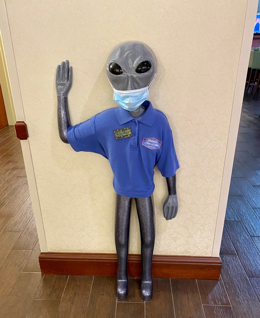
- Day Thirteen:
- Roswell, NM (overnight)
- Day Fourteen:
- Drove straight through Texas and stopped at our first Buc-ee’s (everything really is bigger in Texas)
- Shreveport, LA (overnight)
- Day Fifteen:
- Finally we arrive home in Georgia!


